Search This Blog

Sunday, April 19, 2020

Kinney (Helena) Lake: Origins of the Name


Today we all know the beautiful mountain lake on the trail to Mount Robson as Kinney Lake. However, there was a time when another name for this lake “floated” around. In the early days of discovery, just after the turn of the 19th century, the name “Helena Lake” was also applied to this glacial body of water. 

Where did the name “Helena” come from and why did the name “Kinney” prevail? Let’s take a look…

In Jane Lytton Gooch’s marvelous book, Mount Robson, Spiral Road of Art, we read: 

“The next morning, September 11 (1907), with supplies for five days, the three climbers followed the river on foot through a British Columbia rainforest… After crossing a smaller branch of the Grand Forks (Robson River) that flowed from cliffs on Robson’s south side, they reached Kinney Lake, named by (A.P.) Coleman to honour his indefatigable comrade (George Kinney) who had seen the lake the previous day.”  (Mount Robson, Spiral Road of Art p.31)

The name Kinney Lake appeared on a holograph map by Coleman in 1908 and another of Coleman’s maps in 1911. The name was officially adopted April 2nd, 1912. 

However, the name “Helena" was still around. In the October 6th, 1910 issue of the Victoria Daily Times there is an article entitled "The Route of the GTP (Grand Trunk Pacific Railroad). It states that a "... large (lake), near Mount Robson, was named Helena." 


This beautiful hand-tinted postcard from the Grand Trunk Pacific Railroad cited the lake as “Lake Helna”. While the original photographer is undetermined the date is circa 1910. It seems “Helna” was either mistaken in name or spelling and should have read “Helena”.


Also, Blanche Hume, of the Alpine Club of Canada records in 1913: 

“We had an amusing experience ourselves when a visit was made to the foot of Mount Robson,” wrote F. A. Talbot after his 1910 reconnaissance of Grand Trunk Pacific Railway construction. “In due course, after some eight hours’ work, the edge of a beautiful stretch of water, first discovered by Mr. Kinney, who named it Lake Helena, was reached. We hastily fashioned a raft. While moving slowly along, what looked uncommonly like a signboard was spied on the bank. Pulling rapidly towards it, to ascertain what it was, we saw, in scrawling print, ‘Site of Mackenzie’s Hotel.’” Hume, Blanche B. “The camp on Robson Pass.” Rod and Gun in Canada (1913).

We see the postcard photo again in the Windsor Star newspaper (September 12, 1913) and it also refers to the lake as "Helena":


If George Kinney named the lake “Helena” we’re not sure why. Helena does not seem to be a Kinney family name (His mother was Elizabeth, he had no sisters named Helena and he was yet to meet his wife Alice in 1920).

Another possibility arises when we see that:  

“A Grand Trunk Pacific railway official requested in 1914 that Kinney Lake be re-named "Helena", after his wife; proposal rejected (Ottawa file, 10 December 1914)”.  

Perhaps this GTP man had been around for a while and wanted the lake to be known for his wife and not George Kinney – as the 1910 GTP article and postcard would suggest. 

At any rate the name Kinney prevailed and, I believe, deservedly so. George Kinney was an integral part of the history of the Mount Robson area and his legacy should indeed be remembered this way. 


Sources and Further Reading:

https://apps.gov.bc.ca/pub/bcgnws/names/4567.html

http://www.spiralroad.com/lake-helena/

https://www.spiralroad.com/george-kinney/ 

Friday, April 17, 2020

Of Math & Miracles (A Poem)

Of Math & Miracles


Of math and miracles
Of science and faith
Of man and God
Of karma and grace

What is math without miracles?
Lame and unkind
And miracles without math?
Sentimental and blind

For who has put wisdom
In the mind?
And guided the heart,
Understanding to find?

Of math and miracles
Of science and faith
Of man and God
Of karma and grace

O taste and see
He is Almighty and kind

Pillars of Creation in the Eagle Nebula 7000 light years from Earth. PC Nasa/ Hubble


 “The eternal mystery of the world is its comprehensibility…The fact that it is comprehensible is a miracle.” Albert Einstein 1936

Job Chapters 38-42

Psalm 34

Friday, April 3, 2020

Tom Heffron: The Mysterious Miner of Kalamalka Lake


Recently I was told of a hermit-type individual who apparently lived in a cave beneath the current Kalamalka Lake Lookout. After some personal investigation and community sourcing from social media the consensus seems to be that this man was one Tom Heffron. 

The only resource I have not been able to look at is the archives of the Greater Vernon Museum as they are closed due to the COVID 19 pandemic. If anyone else has more information (especially with first hand sources) I would welcome it! But for now, here is the story of the mysterious miner of Kalamalka Lake:

Bill Leeper, who grew up in the Vernon area, was the first to call this local legend to my attention. Bill says his father would often visit the hermit during the war times. Leeper reports:

“(The hermit) lived in the cave below the lookout. My dad was probably about 8 or 9 at the time, very early 40's, wartime. Dad used to go visit him and bring him stuff, one of his favorite things was canned milk, and the old fellow would make him a hot coco using some of the canned milk.”

An early view of the Kal Lake Lookout on the old highway


Leeper also recalls visiting the cave site with his father around 1963:

“… I asked him to take me and show me the cave, I probably thought the hermit would be still be there. We drove up to the lookout, looked over the railing down below… (I) got down to the cave and the path went between a big rock that blocked the entrance from view and there was the cave, so of course my imagination was filled with all kinds of stuff, but no hermit...”

After some social media discussion another person posted the following obituary of a man named Tom Heffron. The dates and details all line up and Bill Leeper agrees that this obituary seems to belong to one and the same person as the hermit his father used to visit. 

According to the obit from the Vernon News (dated June 29, 1950), Tom was born in Ireland on March 1st, 1872 and had resided in the Vernon area for about 43 years dabbling in logging, rail laying and mining ventures. The obit goes on to say:

“In later years he chose to live in a rough shack, thrown against the side of a gully, in the hills beside Kalamalka lake and to the east of the Vernon-Kelowna road.”


This description fits closely to Bill Leeper’s location of Tom’s living quarters. It is thought he likely lived in both a shack and a cave in the vicinity below the current look out. Unfortunately, Tom was found dead in his shack “in the hill bordering Kalamalka Lake” on a Sunday evening (perhaps June 25th, 1950 before his obituary appeared in the local paper that Thursday*). His funeral was held on the Tuesday and he was buried in the old part of Pleasant Valley Cemetery. 

What else do we know about this mysterious man? The Vernon News obituary says: “He was quite a familiar figure, striding along the road at a brisk pace, with his cane, usually a pack on his back and sometimes carrying a shovel to one of his 'mines'”.

Further investigation found his name in the 1921 Canada Census, which actually lists him being born one year earlier in 1871. It recalls his year of immigration from Ireland as 1886 and, surprisingly, lists that he was married – to a Norah Heffron (who was also born in 1871 in Ireland). Who was this Norah and when did she die or disappear from the picture? I have not been able to find out as of yet but perhaps this heartbreak is what drove Tom into a recluse lifestyle.

A few other things we know about Tom from some old newspaper articles are that he liked to try and foretell the weather for the orchardists and also that he claimed to be the one responsible for introducing the Concordia Grape to the Okanagan.

The Vancouver Province, August 28th, 1948

“Tom Heffron, who holes out in the Vernon district, wears a full beard, and reads signals in the sky which tell him what the weather is going to be like, has solemnly warned the orchardists to be prepared for early frosts.”  

The Vancouver Sun, September 14th, 1949

“Mr. Tom Heffron, of Sappa Ranch, Shower Bath Road, Vernon, B.C., writes… “It all happened through the young son of a farmercoming to the gang laying steel for the Canadian National Railways from Kamloops to Kelowna. This school-boy came to our steel gang with a water bucket full of Concord grapes and they were a very good sight for sore eyes… To make a long story short, I told the boy to tell his father to plant out his whole farm (160 acres) in Concord grapes.” 

What's left of the cave below the lookout that Tom may have lived in. PC Bill Leeper

Take these newspaper articles for what you will but they certainly reveal that Tom Heffron was an interesting character! My hope in writing this blog is to revive some old history surrounding Kalamalka Lake but, more importantly, to help leave a bit of a legacy for this man about whom little remains known…


*finadagrave.ca lists his death date as June 8th, 1950


Friday, March 20, 2020

Kalamalka Lake: A Historical Timeline


Here is a chronological list of historical events that have occurred in, on and around Kalamalka Lake – the Treasure of the Okanagan. This is a big picture look at some local history and I hope that this can be a useful tool in the study and appreciation of this beloved lake. If you feel there are any other significant details that could be added please comment below with specific dates and sources. 

For much more detailed information and stories please see the highlighted links or visit:


Origins

Kalamalka Lake is a glacial lake which remained after the immense Lake Penticton (which covered most of the Okanagan Valley) receded. 

Kalamalka Lake is “one of a handful of unique bodies of water known as marl lakes” (BC Parks). In the summer as the lake warms, calcium carbonate, or limestone (left by past glaciers), forms crystals that reflect sunlight. This results in a breathtaking array of blue, green and turquoise colours.

Pre- 1800

The Okanagan First Nations are the first people to live here. They hunted and fished over a wide territory including present day lakes: Okanagan, Kalamalka and Wood.

Kalamalka Lake and Wood Lake, however, were known as a single lake at the time. It was referred to by the Okanagan First Nations as “Chilutsus” (Chil-loot-sus) meaning “long lake cut in the middle”.

Early colonial maps call the isthmus between the two bodies of water "The Railroad" likely after an Indigenous structure made of logs to make the isthmus more passable. The Okanagan People called this isthmus "acyuÊ”c̕us (Ac yutz oos)". 


c.1800

Chief Kalamalka is born. This is an estimate based on the census data of his son and granddaughter’s births. He resided at the head of what is now Kalamalka Lake or “N’Inkamuplux” (Head of the Small Lake). Kalamalka is a noble and well respected man by both the Indigenous peoples and later the European settlers.

One theory as to the origin and meaning of Kalamalka is that it may be a form of the Okanagan Indian word “Kenamaska” which refers to the soft velvet of a deer’s antlers. “The word in reference to the Chief, meant he was a mild mannered man, well respected by his people (Antoine)”. 

A second theory is that the name has Hawaiian origins (see 1814).

1811

David Stuart, of the Pacific Fur Company becomes the first (recorded) White man to see the Okanagan Valley. 

1814

Louis Peon arrives at the head of Okanagan Lake from his native Hawaii. Peon was a “Kanaka” (a native Hawaiian brought over to Canada by the Hudson’s Bay Company). 

Historian, F.M. Buckland believes it was Peon who bestowed the Hawaiian word “Kalamaleka” (possibly meaning “Sun of the Americas”) to a family in the Okanagan area. Although possible, Peon arrives about 14 years after Chief Kalamalka’s estimated birth. It is also possible a different Kanaka came earlier to the Okanagan area. 

c.1822

Quo-hast-a-mayna, son of Chief Kalamalka, is born according to census data.

Quo-hast-a-mayna on the right


c.1847

Katrine (or Catherine), the daughter of Quo-hast-a-mayna and granddaughter of Chief Kalamalka, is born according to census data.

c.1851

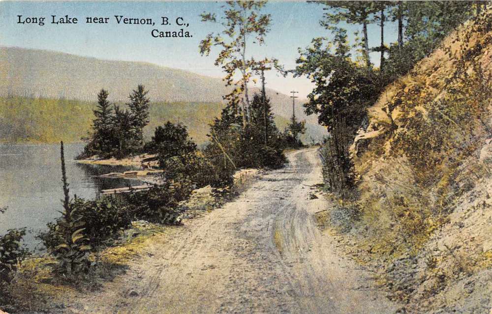
White settlers began referring to both lakes (now Kalamalka and Wood) as Long Lake; however, the southern lake (now Wood) was also known as Pelmewash Lake (thus the name of the new parkway). The name Pelmewash is confirmed on an 1871 map of British Columbia by Trutch.

1863

Charles Houghton arrives in the Okanagan Valley along with Forbes and Charles Vernon (all from Ireland).

Upon exploring the area, Houghton finds what is now Coldstream Creek.  “The stream he named Coldstream Creek. And on its banks he intended to locate his military grant, which he would call “Coldstream” (Coldstream Nulli Secundus p.2).


1871

Thomas Wood (from Newfoundland) acquires a pre-emption for land at the south of “Long Lake” (obviously referring to both the north and south lakes as one lake). Wood names his new ranch “Winfield Lodge” and the south lake is later named after Thomas Wood.

c. 1873

Katrine Kalamalka and Forbes George Vernon have a daughter named Louise through a common law marriage. She later marries George Tronson, son of E.J. Tronson. Katrine and Forbes also have a daughter named Mary (later McDougall), birth date unknown. (Source: Q'sapi)

1874

John Jane surveys the Coldstream area and reports: “the land at the mouth of Coldstream Creek is occupied by an old Indian named Francois (*probably Quo-hast-a-mayna, son of Kalamalka), who has about 40 to 60 acres fenced and under cultivation. He has a paper dated 1861 signed by Judge Cox warning people not to trespass on this ‘Indian Reservation’.” (An Early History of Coldstream & Lavington by Anne Pearson p.3-4)

1875

Construction begins on the Okanagan and Mission Valley Wagon Road which connects Kelowna to Vernon and beyond. It runs along side Kalamalka and Wood Lakes. 

1892

Vernon, British Columbia becomes the first city incorporated in the Okanagan Valley. It is named after local Irish pioneer Forbes George Vernon.

The main hotel in Vernon is built and named the Kalamalka Hotel in the Chief’s honour.


1893

Cornelius Cosens emigrates from Chichester, England and homesteads on “Long Lake”. Cosens Bay is named for him and his family. 

1906

Coldstream is incorporated as an official district municipality.

The settlement of Oyama is named after the Japanese Field Marshal, Oyama Iwao, by the local postmaster and his wife.

1908

There was once a creek joining the two lakes until a navigational canal is built between the two bodies of water and still exists today. It is said that Wood Lake dropped by four feet when the canal was made until it was finally level with Kalamalka Lake.


Egbert and Annie Trask (who moved to the Okanagan from Nova Scotia) purchase “Iris Point” (What is now Kaloya Regional Park) and build a home there.

"In October 1908 seventeen Natives... signed a surrender document which gave the Federal Government the right to sell the Indian interest in the Reserve (Long Lake Indian Reserve No. 5).” (Vernon and District Pioneer Routes by Theresa Hurst p.64-65). Immediately many complaints arose from Indigenous people as well as missionaries as to the validity of the document and how it was obtained. 

1909

Despite the complaints about the surrender of the land, the B.C. government issues a crown grant to John Kennedy for the land comprising the Long Lake Indian Reserve No. 5. Kennedy would later sell portions to the city of Vernon and to CN Rail. Many years later in 1984 the Federal and Provincial governments make a payout to the Okanagan Indian Band for the controversial land. 

1910

What is now the heritage home “Mackie Lake House” is built on the shores of Kalamalka Lake by architect Robert Findlay. 


1912

The Vernon News reports a movement to change the name from Long Lake to Kalamalka Lake.

1913

The Kalamalka Agricultural Association is formed in Oyama

1914

The Kalamalka Women’s Institute is established in Oyama by Annie Trask. Later, wounded WW1 soldiers would convalesce at the Trask home.


1919

Edward Albert, the Prince of Wales (and later King Edward the VIII who abdicated the throne) makes an automobile trip along Kalamalka Lake from Vernon to Kelowna. 

1926

An obituary for Mrs. Louis Bercier, aka Katrine or “Coldstream Kate”, is printed in the Vernon News. She was the granddaughter of Chief Kalamalka.

The CN Rail opens its line along Kalamalka Lake from Vernon to Kelowna. It is operated by Kelowna Pacific Railway.

1927

A young boy from the Vernon Preparatory School (near Kalamalka Lake) sets out to get a rattlesnake rattle for his mother. The boy is bit by a rattlesnake and later succumbs to his injuries. 


The headmaster of the school, Rev. Austin Mackie, is so overwhelmed with grief at the boy’s death he makes a lifelong commitment to hunt and kill the rattlesnakes of the Coldstream and what would later be Kalamalka Lake Provincial Park.

c.1935

The English spelling and pronunciation of the word “Kalamalka” is confirmed when the owner of the hotel attempts to put up a new sign with the spelling “Kalemalka” (pronounced kaleem-alka). His two daughters and the local old timers insist it should be “Kalamalka”. 

c.1940

Kalamalka Lake and its parks are used for combat practice during WW2. “During the war amphibious assaults were practiced on Kalamalka Lake, with the ships launching from Kekuli Bay. Guns would be firing as they approached Cosens Bay” (Know Your Park, www.kalamalkapark.ca).

1944

A.V. Despard publishes a poem called “The Lake of Many Colours (Commonly Called Kalamalka)”. This is the first recorded mention of that nickname to describe Kalamalka Lake. 

The Canadian Navy launches a mine-sweeping vessel and names it the HMCS Kalamalka in July. She operated out of Prince Rupert as a patrol vessel looking for possible mines during WW2.


1951

Pioneer, Sara Newton, writes her poem: Lake Kalamalka

1953

The name “Kalamalka” was officially gazetted as a name for the northern lake. 

1956

A group of 25-30 American tourists claimed to have seen the Ogopogo ('N’ha-a-tik' in Syilx) in Kalamalka Lake.

1958

A popular song by Paul Malysh and Eric J. Hopkins entitled "The Kalamalka Calls (Lake of Many Colours)" is written and recorded.

1974

An orchestral piece composed by Jean Coulthard named "Kalamalka - Lake of Many Colours” is published.

1975

Kalamalka Lake Provincial Park is officially established on land formerly belonging to the Coldstream Ranch.


Kaloya Regional Park is created by the Regional District of the Central Okanagan on what was once the Trask’s property in Oyama.

1981

The Cougar Canyon Ecological Reserve near Kal Park is created.

1985

James Malcolm Macartney publishes his master’s thesis: “The Ecology of the Northern Pacific Rattlesnake, Crotalus viridis oreganus, In British Columbia”. Much of the detailed study took part in Kalamalka Lake Provincial Park and the lands belonging to the Coldstream Ranch – the same areas that Austin Mackie would have hunted. This study has since become a foundational Rattlesnake study for biologists all over North America.

1990

Kekulia Bay Provincial Park is established on the west side of Kalamalka Lake. It was named after Indigenous subterranean homes (pit houses) with log roofs. There is archaeological evidence of these and other Okanagan First Nations artifacts in both 
provincial parks.


1995

Oyama becomes a ward of the newly formed municipality of “Lake Country” (along with Winfield, Okanagan Centre and Carr’s Landing). 

2013 

CN Rail ends its operation of the railway along Kalamalka Lake. In the years to come the right of way is purchased by local governments and transformed into The Okanagan Rail Trail. 


Sources and Further Reading:

http://www.lakecountrymuseum.com/kalamalka-name-re-visited/#top
https://apps.gov.bc.ca/pub/bcgnws/names/23969.html

Q’Sapi: A History of Okanagan People as Told by Okanagan Families (Theytus Books)

Vernon and District Pioneer Routes by Theresa Hurst (Published by the Vernon Branch Okanagan Historical Society)

An Early History of Coldstream & Lavington by Anne Pearson copyright 1986 (Wayside Press)

Kalamalka: A Collection of History and Photography by Joseph Harder (Blurb.ca)

Saturday, February 1, 2020

Mount Robson: A Historical Timeline

After much research, here is a comprehensive list of historical events that have occurred in, on and around Mount Robson - the Monarch of the Canadian Rockies.  I hope that this can be a useful tool in the study and appreciation of this beloved peak. If you feel there are any other significant details that could be added please comment below.

For further reading please check out my blog:
Each mark on this timeline points to a deeper story of the mountain and its people. It is the story of creation, First Nations, pioneers, explorers, climbers, scientists, artists, poets, railway men and outfitters. It is the story of Mount Robson in point form. 

Geological Origins

Mount Robson is a peak in the Rainbow Range of the Rocky Mountains in eastern British Columbia. These mountains are “raised layers of sedimentary rocks formed on the floors of ancient seas” (Royal BC Museum). One geology blog describes Robson as a 12,792 foot tall layer cake with limestone and dolomite on the top, shale in the beige coloured middle and quartzite on the bottom. While the layers may seem to be horizontal they are actually part of a huge syncline (fold of stratified rock in which the strata slope upward from the axis).

From the base of Mount Robson in the Fraser River Valley to its peak there is a 3,000 metre rise over a distance of only three kilometres… “it is not far below that of Mount Everest and is unrivaled in the Canadian or U.S. Rocky Mountains” (Bill Corbett). 


Pre-1800

Prior to the fur trade entering the Leather (Yellowhead) Pass, the Simpcw were the first known inhabitants of the Upper Fraser area, they were nomadic and a part of the Shuswap (Secwepemc) people. They built lodges and fish drying racks near the confluence of the Fraser and McLennan rivers (near present day Tete Jaune, BC). Their territory extended from north of McLure, BC into Jasper, Alberta and there are archaeological finds throughout this area.   

The First Nations name for the mighty peak was “Yuh-hai-has-kun”, meaning The Mountain of the Spiraling Road which referred to the strata-like layers of the mountain that angle upwards to the East. (From G.M. Dawson’s Report on the Shuswap People)

"Shuswap Indians" at Tête Jaunce Cache 1912. (Photo by F.A. Talbot, from the Simpcw First Nation Archive)


1819

Pierre Hatsination (also known as Tete Jaune, a fair haired Iroquois) is sent by Colin Robertson of the Hudson’s Bay Company to trade in B.C. 

Pierre probably established a cache near the confluence of the Grand Forks (now Robson) River and the Fraser River near the foot of Mount Robson. The most likely theory as to the name of Mount Robson is that Pierre named it after his boss and that it later evolved into “Robson”. 

1827

George MacDougal’s journal entry for April 25, 1827 is the first written record of Mount Robson’s current name. He referred to it as “Robinson” thus showing the likely evolution of the name. 

1862

The famed “Overlanders” who started from Toronto make their way to Tete Jaune Cache and see the illustrious Mount Robson. John M. Sellar makes this journal entry on August 26 referring to Robson by its nickname: “At 4pm we passed Snow or Cloud Cap Mountain Which is the highest and finest on the whole Leather Pass.” 


The Yellowhead Pass by William G.  R. Hind of the Overlanders


1863

The English explorers, Dr. William Butler Cheadle and William Fitzwilliam, the Viscount of Milton, search for a Northwest passage overland within British Columbia. 

On July 14, Cheadle records the sight of Mount Robson: “…immediately behind us, a giant among giants, and immeasurably supreme, rose Robson’s Peak.” Thus the evolution of the name was complete. 

1876-77 

The Canadian Pacific Railway sends surveyors through the Yellowhead pass to assess its viability for the new Transcontinental Railway. Despite Sir Sanford Fleming’s recommendation to build the railway through the Yellowhead pass, it is later decided to build the railway through the Kicking Horse pass further south. 

1906

A.O. Wheeler and Elizabeth Parker found the Alpine Club of Canada

1907

A.O. Wheeler sends artist and geologist, A.P. Coleman, to explore Mount Robson with the hope of climbing the peak and claiming it for the new Alpine Club of Canada. Coleman is joined by his brother, Lucius, a packer named Jack Beder and a Presbyterian Minister by the name of George Kinney. They tried but failed to climb Mount Robson from the south. 

On September 11th, the Coleman party reaches Kinney Lake (which had also been known as Helena Lake) and Coleman named it after the good Reverend. Coleman also names Resplendent Mountain.

By this time three different routes had been surveyed by three different railway companies through the Yellowhead Pass. The CPR had done so decades earlier and now the Grand Trunk Pacific and the Canadian Northern were competing to construct the first railway there. 


1908

On July 31st, A.P. Coleman left Edmonton to begin his second expedition to Mount Robson. Along with Lucius and George Kinney he added packer John Yates and guide Adolphus Moberly. This time they attempted to climb Mount Robson from the north but time and weather prevented them.

The group named one lake after their guide Adolphus and the other they named Berg Lake because of the large glacier (formerly Blue Glacier, now known as Berg Glacier) that flowed into it and dropped great chunks of ice into it. They also came across for the first time geographical features now famously known as Extinguisher Tower and The Dome. 

Coleman names The Helmut because of its resemblance to a Roman soldier’s headpiece. 

In August, Mary Schaffer and Mollie Adams make the trek from the Athabasca to Tete Jaune with the intent of seeing Mount Robson. Many of Mary’s lantern slides of the area remain in museums to this day.


Arthur Philemon Coleman: Cutting Steps, Robson Glacier /
The figures depicted are Lucius Coleman, George Kinney and John Yates


1909

Upon hearing that a group of foreigners were going to attempt the peak of Robson in the summer, George Kinney hastily makes plans to climb it on his own in June (Coleman was still teaching at University). 

After meeting a young outfitter named Donald “Curly” Phillips, Kinney asks him to accompany him to the summit. In an extraordinary feat of human endurance and determination, they scaled the mountain on the West Face and Kinney claims they reached the peak on Friday, August 13. It appears that at first the Alpine Club of Canada accepted this as fact. 

Kinney discovers “The Gargoyles”, “…fantastic masses of crystal, forming huge cornices all along the crest of the peak.”

British climber, Arnold L. Mumm and his Swiss guide Moritz Inderbinen (the “foreigners” that Kinney was afraid of) attempt another climb of Robson’s Peak but fail. Mumm would try again in 1910 and 1911 without success.


George Kinney


1910

The Grand Trunk Pacific Railway is built through the Yellowhead Pass


1911

A.O. Wheeler and the Alpine Club of Canada mount another expedition to Robson in an attempt to explore and produce a topographical survey. The information gathered on this trip will eventually help inspire the British Columbian government to make the area around Mount Robson a provincial park.

The party discovers Arctomys Cave near Robson. The cave is 1608 feet deep and for a long time was the deepest known cave in Canada. 

Wheeler names the majestic falls with the massive mists “Emperor Falls”

Conrad Kain, an Austrian, is the first man to summit Whitehorn Mountain

After completing his survey of the Robson area, A.O. Wheeler plants a wooden post with an inscription marking the border between B.C. and Alberta.


Conrad Kain


1912

The Grand Trunk Pacific hires Francis Rattenbury (who also designed the Empress Hotel) to design a Chateau Mt. Robson. Unfortunately the chateau never came to fruition as the GTP went out of business.


1913

The Provincial Government hires Curly Phillips to build a trail to Berg Lake including his famous “flying” trestles.

On March 11, Mount Robson Provincial Park is officially founded – the second oldest provincial park in B.C. 

The Alpine Club of Canada holds their annual camp at Mount Robson, July 28- August 9.
On July 31, 5:30pm, Conrad Kain, William W Foster and Albert H. MacCarthy ascend the summit of Mount Robson via what is now known as “Kain’s Face”. 

The next night Curly Phillips stuns the celebrating crowd at the ACC camp by telling them that he and George Kinney did not reach the summit of Mount Robson in 1909. Kain is credited with the first summit. Kinney continued to claim that he had reached the peak in 1909 but Phillip’s statement broke his heart.

The Canadian Northern Railway is built through the Yellowhead Pass

1914

A.Y. Jackson (a future member of the famed Canadian painting association, “The Group of Seven”) and William Beatty (another important Canadian artist) are hired by the Canadian Northern to paint scenes along their railway. They make multiple paintings of Mount Robson. 

Sir Arthur Conan Doyle, creator of the famed detective Sherlock Holmes, visits the Canadian West with his wife. A special train is procured to take them to Mount Robson. Doyle later wrote a poem about his adventures entitled “The Athabasca Trail”. 


By A.Y. Jackson


1916

In a dark part of B.C.’s history, the Simpcw People are forcibly, and without warning, relocated from their settlement at Tete Jaune to Chu Chua – nearly 300 Kilometres away (south of Little Fort, BC). Despite a railway existing along this corridor, the Simpcw were made to walk. Today there are nearly 700 members of the Simpcw First Nation who still live, work and continue their cultural heritage in Chu Chua. 

1919

The Grand Trunk Pacific merges with the Canadian Northern to become the nationalized “Canadian National Railway”. 

c. 1920


A.O. Wheeler lowers his earlier measurement of the height of Robson from 13,068 feet to 12,972 feet which is the official height still used today. 


1921

The Hargreaves brothers (George, Frank, Roy, Jack and Dick) establish The Hargreaves Brothers Outfitting Company near Mount Robson. They are hired by the CNR to build cabins in the Robson Pass which Roy operated for several years. 


Some of the Hargreaves Brothers


1922

The very first automobile trip through the Yellowhead Pass is conducted by C.W. Neimeyer and Frank Silverthorne. They started in Edmonton and ended in Victoria. The “road” consisted of abandoned railway beds and actual railway line. 

The Hargreaves adopt two orphan black bear cubs which they often take to the Robson train station for travellers to see. They are immortalized in an iconic photo.

1924 

Phyllis Munday becomes the first women to climb Mount Robson. Conrad Kain was her guide. 

Lawren Harris, also a future member of The Group of Seven” paints alongside Jackson on another trip to Robson.


1927

Roy Hargreaves builds the Berg Lake Chalet by Berg Lake and hosts many guests there. 

1930

American climber Newman D. Waffl becomes the first known person to die attempting to scale Mount Robson. His body was never found and a mountain was later named after him. Sophia Hargeaves (wife of Roy) had the difficult task of writing Mrs. Newman to inform her of her husband’s tragic death. 

1937

Film maker, Hamilton Jones, shoots an award-winning Western movie in the Mount Robson area called “Western Holiday”.


1938

Celebrated guide, Hans Fuhrer, leads a party up the north ridge of Robson. It is now called the Fuhrer Ridge in his honour. 

1939

King George VI and Queen Elizabeth stop at Mount Robson on their Canadian tour. 

B.C. Provincial Police officer, Wilfred Hovey Olts, begins his stay at Red Pass and Mount Robson (The RCMP were not yet in B.C.). He accompanies the Royals as the police presence on the train and must have been impressed with them as he later named his daughter Elizabeth.

1946

Famed pioneer of the Robson Valley, Ishbel Hargreaves (daughter of Roy and Sophia), marries Murray Cochrane (a guide working for Roy). 

1959

American climber, Leo Slaggie, finds the bottle that George Kinney had planted on that controversial “first” summit. He found it just below Emperor Ridge and in it were names and a Canadian Flag. 

Roy Hargreaves retires and sells his ranch to American marine biologist, Alice Wright. She names it “Mount Robson Ranch”. 

1954

Noreen Carr and her husband purchase 160 acres where the current Mount Robson Provincial Park Visitor Centre is now located. She goes on to become an accomplished artist of the Robson Valley.

1962

In March, the valley was named after the mountain by the Dunster Farmer’s Institute who held a contest to see what they would call it. The valley that lays at the foot of Mount Robson is approximately 150 miles long and extends from the Yellowhead Pass to Dome Creek, BC. 

Hans Schwarz makes his first of 12 successful attempts to summit Mount Robson. The “Schwarz Ledges” near the top of Robson came to be named in his honour.

1969


The Ralph Forster Hut is built to house climbers using the South Face of the mountain (an avalanche had wiped out its forerunner building).


1970

Premier W.A.C. Bennet officially opens up the new Yellowhead Highway through the Yellowhead Pass.

The Carrs are forced to sell some of their land but use the opportunity to open a coffee shop and gas station at Mount Robson. 


Berg Lake Chalet (now Hargreaves Shelter)


1977

The famous “Grizzly Group” including photographer and artist Glen Boles, summits Mount Robson. 

1978

The Berg Lake Chalet, now owned by Alice Wright, is forced to close down but later (1982) reopens as the Hargreaves Shelter where weary hikers to Berg Lake can take shelter. 

Mount Robson Lodge and Robson Shadows Campground is founded in 1978 by the Cinnamon family.

1979


Don Forest (a member of the Grizzly Group) becomes the first person to climb all of the official 11,000 foot peaks in the Canadian Rockies. The Robson group of 11,000ers includes Robson, Resplendent, The Helmut and Whitehorn. 


1980

Murray and Ishbel  (nee Hargreaves) Cochrane take over the Mount Robson Ranch from Alice Wright. 

1984

In August, American climbers Nicholas Vanderbilt (great-great grandson of American tycoon Cornelius Vanderbilt) and Francis Gledhill Jr. disappear after attempting to summit the peak. Their bodies were never found. 

1991

Mount Robson park ranger, Rick Blak, is tragically killed while exploring Arctomys cave. 110 people were involved in the recovery of his body.

2012


In August, climber Bradley Charles Joyce of Alberta is killed when a snow bridge collapses underneath him as he descended the mountain. 

Canadian-born climber, Barry Blanchard, finishes the 2200 metre route up the Emperor Face named “Infinite Patience”. 

2013


Local brothers from nearby Valemount, Andreas and Reiner Thoni, establish a new route to the Kain Face via the South Face Spur.   


2016


The late mountain climber, Marc Andre Leclerc, achieves the first solo ascent of Mount Robson’s Emperor’s Face. He is the subject of the documentary “The Alpinist”. 


"Before the mountains were brought forth, or ever You had formed the earth and the world, even from everlasting to everlasting, You are God.” Psalm 90:2


Sources & Further Reading:

Mount Robson: Spiral Road of Art / Jane Lytton Gooch / Copyright 2013 

The Yellowhead Pass and Its People / Valemount Historic Society / Copyright 1984

The Robson Valley Story / Marilyn Wheeler / Copyright 1979

The 11,000ERS of the Canadian Rockies / Bill Corbett / Copyright 2016

Simpcw First Nation website 


Memoirs of an Outfitter’s Daughter / Valemount Historic Society / Copyright 2008